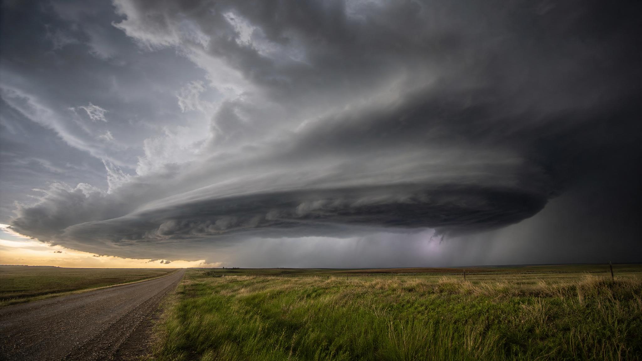
The severe-weather focus on Thursday, June 4, is centered on the Plains and Upper Midwest, where moisture, daytime heating, a frontal boundary, and passing disturbances are expected to overlap later in the day.
The NOAA Storm Prediction Center's 1300 UTC Day 1 Convective Outlook says there is a Slight Risk of severe thunderstorms Thursday afternoon and evening over portions of the northern Plains. SPC highlights large to very large hail and damaging winds from parts of the northern High Plains across northern Nebraska and much of South Dakota.
That does not mean every town inside the risk area will see severe weather. It means the atmosphere is expected to support storms that can become severe, especially where individual cells form and organize.
Severe weather June 4, 2026: areas to watch
SPC's highest Thursday severe-weather concern is across portions of the northern Plains. The outlook calls out the northern High Plains, northern Nebraska, and much of South Dakota as areas where storms could produce large hail and damaging winds.
Farther south, SPC describes another corridor from northeast Kansas into Iowa. A disturbance moving out of western Kansas is expected to help trigger scattered afternoon thunderstorms. If enough heating occurs, stronger storms could produce hail and damaging wind gusts across parts of Kansas, Nebraska, and Iowa later Thursday.
The exact storm coverage remains an important uncertainty. SPC noted that an upgrade was considered for part of the Kansas, Nebraska, and Iowa corridor, but confidence was limited by cloud cover and precipitation near the disturbance. That is why readers should refresh the outlook and local alerts later in the day instead of relying only on a morning map.
What hail and damaging wind mean in practice
A severe thunderstorm is not just a loud storm. The National Weather Service defines a severe thunderstorm as one capable of producing hail at least one inch in diameter or wind gusts above 58 mph.
Hail that size can damage vehicles, roofs, crops, outdoor equipment, and windows. Very large hail can be dangerous for anyone caught outside. If a severe thunderstorm watch or warning is issued for your area, move vehicles under cover only if it is safe to do so before storms arrive.
Damaging winds can break tree limbs, knock over trees, damage outbuildings, and cause power outages. Before storms arrive, bring in lightweight outdoor items such as patio umbrellas, trash bins, sports equipment, and loose yard decorations. During the storm, stay away from windows and avoid rooms where falling trees could strike.
Is there a tornado risk?
The tornado threat on Thursday appears lower than the hail and wind threat, but it is not zero. WPC's short-range discussion says the northern Plains setup includes a chance for a couple of tornadoes. SPC's Friday outlook also mentions the possibility of a couple tornadoes in the central Plains setup.
This is the key planning point: a tornado watch and a tornado warning are not the same. A tornado watch means tornadoes are possible in and near the watch area. A tornado warning means a tornado has been sighted or indicated by radar, and people in the warned area should move to shelter immediately.
Do not wait to see the storm. Tornadoes can be rain-wrapped, occur after dark, or be hard to see until they are close.
Flash flooding is a separate risk
Severe wind and hail are not the only concerns on Thursday. WPC's short-range discussion says repeated rounds of showers and thunderstorms may develop along a stalled frontal boundary from the northern and central Plains into the Upper Midwest.
WPC highlights a Slight Risk of excessive rainfall over portions of eastern Nebraska and western Iowa on Thursday. A broader Marginal Risk covers much of the Plains into the Upper Midwest. Flash flooding can happen even where the severe-thunderstorm risk looks modest because slow-moving or repeated storms can overwhelm drainage.
The safest driving rule remains the simplest one: do not drive through flooded roads. Water can be deeper, faster, or more damaging than it looks, and the road surface may be washed out underneath.
No watch this morning does not mean no risk later
As of SPC's current watches page update at 12:20 UTC on June 4, no convective watches were valid. As of the mesoscale discussions page update at 12:19 UTC, no SPC mesoscale discussions were in effect.
That is useful context, but it is not an all-clear. Watches and mesoscale discussions are shorter-fuse products. They are often issued closer to storm development, when confidence improves about timing, location, and hazards.
Before afternoon travel, outdoor work, sports, or evening plans, check your local National Weather Service forecast, SPC watches, local radar, phone alerts, and a NOAA Weather Radio or trusted local broadcast source if you have one.
Friday could stay active
The severe-weather setup does not end with Thursday. SPC's Day 2 outlook for Friday, valid from 1200 UTC June 5 through 1200 UTC June 6, shows a Slight Risk across central and eastern Nebraska, northern Kansas, much of Iowa, southern Minnesota, and southwest Wisconsin.
SPC says scattered severe storms on Friday afternoon into Friday night may be capable of large to very large hail, damaging winds with potentially significant gusts, and perhaps a couple of tornadoes from portions of the central Plains into the Upper Great Lakes.
The Friday discussion also says an upgrade to an Enhanced Risk could be considered if later model guidance increases confidence in more concentrated storm development along the Nebraska and Iowa segment of the front.
A practical checklist for Thursday afternoon and evening
- Search your city or ZIP code at weather.gov for your local forecast and alerts.
- Keep your phone charged and enable Wireless Emergency Alerts.
- For tornado warnings, use a basement or interior room on the lowest floor of a sturdy building, away from windows.
- If you can safely move vehicles under cover before storms approach, do it before thunder or lightning starts.
- Bring in or tie down lightweight items that can become airborne in severe wind.
- Avoid low-water crossings, underpasses, and roads that frequently flood.
- Do not rely on outdoor sirens alone. Use phone alerts, weather radio, and local NWS updates.
- Refresh the forecast before commuting, driving kids to activities, or heading to an outdoor event.
FAQ
What states have the highest severe-weather risk on June 4?
SPC's Thursday Slight Risk focuses on portions of the northern Plains, including areas from the northern High Plains into northern Nebraska and much of South Dakota. Additional isolated severe storms are possible farther south across parts of Kansas, Nebraska, and Iowa.
Are there severe thunderstorm or tornado watches right now?
At the final pre-publication refresh, SPC reported no valid convective watches at 12:20 UTC on June 4. Watches can be issued later, so readers should refresh SPC and local NWS alerts before afternoon and evening plans.
What is the biggest storm threat today?
Large to very large hail and damaging winds are the main severe-weather threats in the SPC outlook. There is also a lower-end tornado concern and a separate flash-flood concern where storms repeat over the same areas.
Why can flash flooding happen outside the highest severe-weather zone?
Flash flooding depends on rainfall rate, storm movement, soil conditions, terrain, and drainage. A storm does not need to produce giant hail or a tornado to drop enough rain to flood roads and low-lying areas.
What should I do if a warning is issued?
For a tornado warning, move immediately to a basement or interior room on the lowest floor of a sturdy building, away from windows. For a severe thunderstorm warning, move inside and stay away from windows. For a flash flood warning, avoid flooded roads and move to higher ground if instructed by local officials.
Bottom line
Thursday and Friday both carry meaningful storm risk across parts of the Plains and Upper Midwest. The most likely severe hazards are large hail and damaging winds, with isolated tornado and flash-flood risks also in play. Treat the afternoon and evening as changeable, not settled, and keep local alerts close.
Sources
- NOAA Storm Prediction Center Day 1 Convective Outlook. Used for the June 4 Slight Risk, hazard areas, timing, hail, wind, and outlook-update language.
- NOAA Storm Prediction Center Day 2 Convective Outlook. Used for the June 5 severe-weather setup and possible Enhanced Risk language.
- NOAA Storm Prediction Center Current Convective Watches. Checked for valid watches at publication time.
- NOAA Storm Prediction Center Mesoscale Discussions. Checked for current mesoscale discussion status at publication time.
- NWS Weather Prediction Center Short Range Forecast Discussion. Used for flash-flood, tornado, and Plains-to-Upper-Midwest weather context.
- NWS Weather Prediction Center Excessive Rainfall Outlook. Used for Day 1 flash-flood risk context.
- National Weather Service severe thunderstorm safety guidance. Used for severe-thunderstorm definitions and safety context.
- National Weather Service tornado alerts guidance. Used for watch and warning definitions.
- National Weather Service flood safety guidance. Used for flood-safety framing.