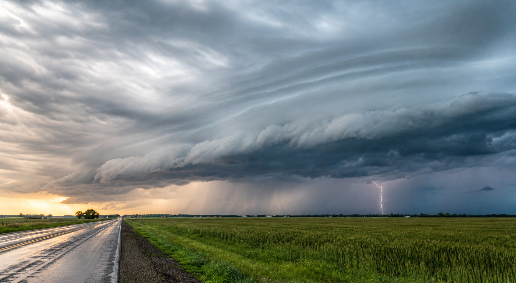
Severe weather on Friday, June 5, is expected to become more important later in the day as storms develop from the central Plains into the Missouri and Mississippi valleys. Morning quiet in some areas should not be read as an all-clear.
The NOAA Storm Prediction Center's Day 1 Convective Outlook, updated at 07:30 UTC Friday, places a Slight Risk of severe thunderstorms across parts of the central Plains, mid-Missouri Valley, and mid-Mississippi Valley. SPC says thunderstorms with large hail and severe wind gusts are expected to develop late this afternoon and evening.
This guide was refreshed before publication against SPC outlooks, SPC current watches, SPC mesoscale discussions, WPC's short-range forecast discussion, WPC's excessive rainfall outlook, and National Weather Service safety guidance. The next SPC Day 1 outlook was scheduled for 1300 UTC, but it had not posted at this pre-publication check.
Severe weather June 5, 2026: areas to watch
SPC's central Friday concern runs from northeast Kansas and southeast Nebraska into southwest Iowa, then downstream into portions of the mid-Mississippi Valley. The outlook says a surface low is expected to deepen over northeast Kansas, with a trough extending northeastward into western Iowa.
As moisture increases and temperatures warm, SPC expects strong instability to develop from northeast Kansas and southeast Nebraska into southwest Iowa. A cap may slow storm development for much of the afternoon, but SPC says it should weaken late in the afternoon or early evening, allowing storms to form near the surface trough.
Once storms develop, they are expected to move east-southeast across eastern Nebraska and south-central Iowa during the early to mid-evening. Later, storms may affect parts of northern Missouri and north-central Illinois.
Why hail and wind are the main concerns
The strongest early storms may be supercells. SPC says forecast soundings south of Omaha and Des Moines support large hail, with hailstones greater than 2 inches in diameter possible in the more dominant storms.
As storms increase in coverage, SPC expects a transition toward a more organized line. That would increase the damaging-wind threat. The outlook says a few wind gusts could exceed 70 mph along the more intense parts of the line.
For households, that means vehicles, windows, trees, loose outdoor items, power lines, sheds, crops, and roof surfaces are the practical concerns. If you can move a vehicle under cover or secure outdoor items, do it before storms arrive, not after thunder or lightning starts.
Upper Mississippi Valley storms are also possible
SPC also highlights an isolated severe threat across parts of the upper Mississippi Valley. Scattered thunderstorms are expected this afternoon across parts of central Minnesota and central to northern Wisconsin, then may move toward the Great Lakes in the late afternoon and early evening.
The risk there is more isolated than the central Plains and Missouri Valley setup, but stronger multicell line segments could still produce severe wind gusts and hail.
Flash flooding is a separate problem
Severe thunderstorms are not the only issue. WPC's short-range discussion, issued at 09:07 UTC Friday, says heavy rain over the southern Plains and along the central Plains to middle Mississippi Valley boundary may cause localized flash flooding through Saturday morning.
WPC's Day 1 Excessive Rainfall Outlook, issued at 08:13 UTC Friday, shows Slight Risk areas for excessive rainfall. The outlook page says the Day 1 Slight Risk population affected is more than 21 million people, with a broader Marginal Risk covering nearly 38 million people.
Flash flooding can happen even where hail and wind are not the main local threat. Repeated storms, very heavy rainfall rates, poor drainage, and low-water crossings can all create dangerous conditions quickly. Do not drive through flooded roads.
No watch this morning does not mean no storms later
At the final pre-publication check, SPC's current watches page was updated at 10:49 UTC and listed no valid convective watches. SPC's mesoscale discussions page was also updated at 10:49 UTC and listed no mesoscale discussions currently in effect.
That status matters, but only as a snapshot. Watches and mesoscale discussions are shorter-fuse products. They are often issued closer to storm development, when forecasters have better confidence about where storms will initiate, how quickly they will organize, and what hazards are most likely.
Before afternoon travel, outdoor work, sports, or evening plans, check your local National Weather Service forecast, SPC watches, local radar, phone alerts, and a NOAA Weather Radio or trusted local broadcast source if you have one.
Saturday risk shifts east and north
SPC's Day 2 outlook, updated at 05:36 UTC Friday and valid for Saturday, places Slight Risk areas from the upper Ohio Valley into southern New England, and over portions of the northern High Plains.
From the Great Lakes and Ohio Valley into the Northeast, SPC says organized storm modes, including bowing line segments and supercells, could produce damaging wind and large hail Saturday afternoon and evening. The outlook also mentions the threat for a brief tornado or two, especially across the upper Ohio Valley.
Over the northern High Plains, late-afternoon or evening storms near the Montana and North Dakota border may support supercell modes with large hail and damaging wind gusts. SPC says the severe-weather threat may continue into the overnight hours.
What to do before storms arrive
- Search your city or ZIP code at weather.gov for local watches, warnings, and forecast timing.
- Charge your phone and make sure Wireless Emergency Alerts are enabled.
- Move vehicles under cover if it is safe to do so before storms approach.
- Bring in or secure patio umbrellas, trash bins, sports equipment, and other lightweight outdoor items.
- For a severe thunderstorm warning, move inside and stay away from windows.
- For a tornado warning, go to a basement or an interior room on the lowest floor of a sturdy building.
- For flash flood warnings, avoid flooded roads and move to higher ground if instructed by local officials.
- Do not rely on outdoor sirens alone. Use phone alerts, weather radio, local NWS updates, and trusted local media.
FAQ
Where is the highest severe-weather risk on June 5?
SPC's Friday Slight Risk covers parts of the central Plains, mid-Missouri Valley, and mid-Mississippi Valley. The more focused hail and wind setup includes parts of northeast Kansas, southeast Nebraska, southwest Iowa, northern Missouri, and north-central Illinois.
Are there severe thunderstorm or tornado watches right now?
At the final pre-publication check, SPC reported no valid convective watches at 10:49 UTC on June 5. Watches can be issued later, so refresh SPC and local NWS alerts before afternoon and evening plans.
What is the biggest storm threat today?
Large hail and severe wind gusts are the main severe-weather threats in the SPC outlook. Stronger storms could produce hailstones greater than 2 inches, and a few wind gusts could exceed 70 mph.
Why can flooding happen outside the worst wind or hail zone?
Flooding depends on rainfall rate, storm movement, soil conditions, terrain, and drainage. A storm does not need to produce giant hail or a tornado to drop enough rain to flood roads, small streams, and low-lying areas.
What changes on Saturday?
Saturday's severe-weather risk shifts toward the Great Lakes, Ohio Valley, Northeast, and northern High Plains. SPC says scattered severe storms may produce large hail and damaging winds, with a brief tornado or two possible in the upper Ohio Valley.
Bottom line
Friday's severe-weather setup is most concerning where late-day storms can form in a strongly unstable environment, then organize into a hail and wind-producing line. The risk does not end Friday night, and Saturday brings a new set of areas to watch. Treat the forecast as a living update, especially if you have outdoor plans, travel, or vulnerable property in the risk areas.
Sources
- NOAA Storm Prediction Center Day 1 Convective Outlook. Used for the June 5 Slight Risk, storm timing, hail, wind, and outlook-update language.
- NOAA Storm Prediction Center Day 2 Convective Outlook. Used for the June 6 severe-weather setup in the Ohio Valley, Northeast, and northern High Plains.
- NOAA Storm Prediction Center Current Convective Watches. Checked for valid watches at publication time.
- NOAA Storm Prediction Center Mesoscale Discussions. Checked for current mesoscale discussion status at publication time.
- NWS Weather Prediction Center Short Range Forecast Discussion. Used for flash-flood, severe-thunderstorm, and multi-day forecast context.
- NWS Weather Prediction Center Excessive Rainfall Outlook. Used for Day 1 excessive-rainfall timing and risk-population context.
- National Weather Service severe thunderstorm safety guidance. Used for severe-thunderstorm definitions and safety context.
- National Weather Service tornado alerts guidance. Used for watch and warning definitions.
- National Weather Service flood safety guidance. Used for flood-safety framing.