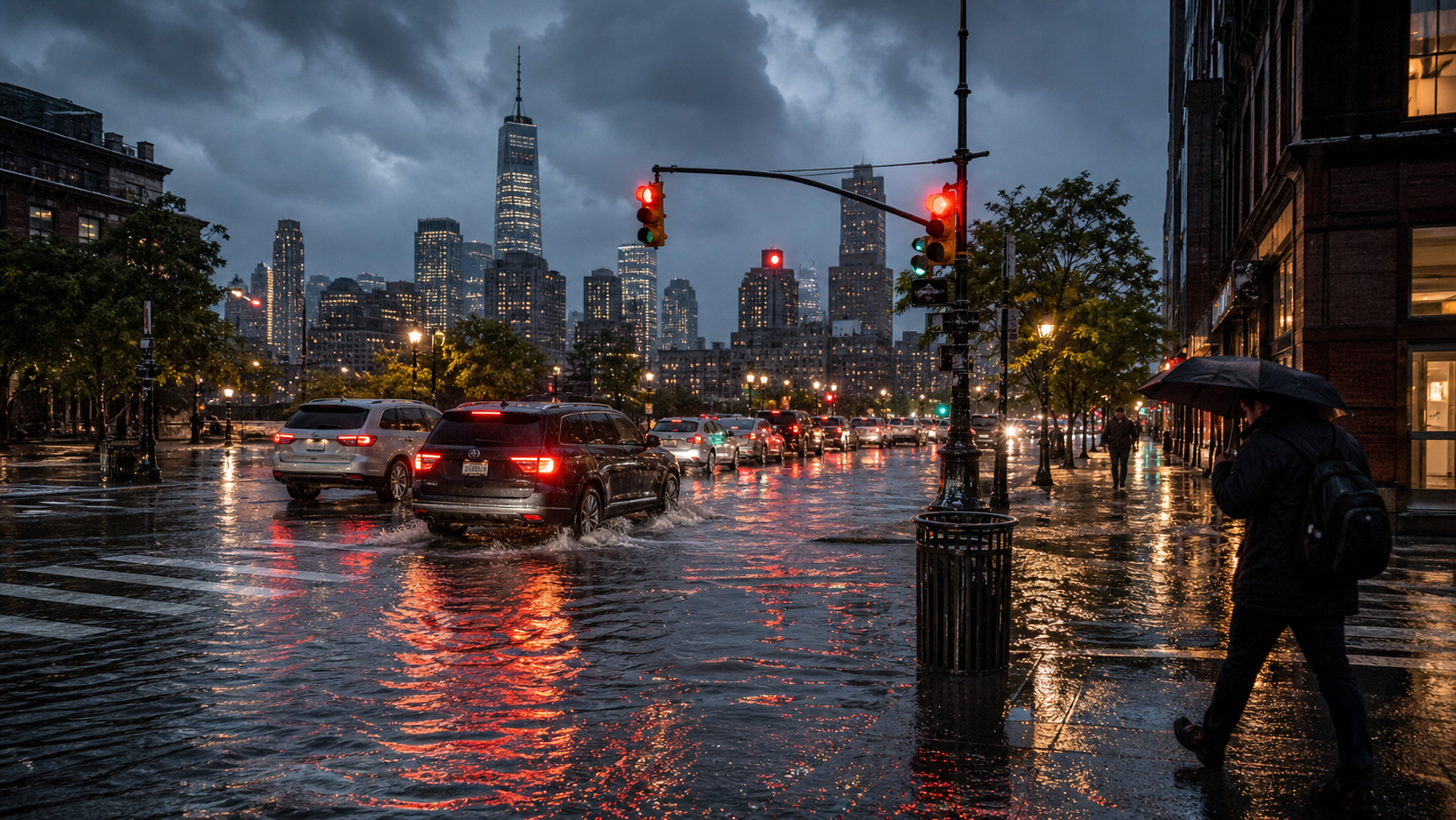
Tuesday's tri-state weather problem is not one scary radar image. It is the overlap of dense population, flood-prone roads, transit friction, low-lying neighborhoods, and repeated heavy rain arriving across a normal workday and evening commute.
That is why this setup deserves more respect than a routine summer thunderstorm. When flash-flood risk lands on New York City, northeast New Jersey, southern Westchester, and southern Connecticut, the real damage often starts with ordinary decisions: taking the usual underpass, parking in the wrong low spot, waiting too long to leave, or assuming a brief lull means the hard part is over.
Why the tri-state is the clearest flood story this morning
The Weather Prediction Center's Day 1 excessive-rainfall outlook, updated at 0815 UTC Tuesday, keeps a Moderate Risk over the tri-state area of New Jersey, New York, and Connecticut and says significant flash flooding is possible today and tonight. Its discussion points to an unusually strong upper-level setup, deep moisture, strong instability, and storm motion that can support training rain over the same areas.
That combination matters because it turns heavy rain into a repeat-hit problem. WPC says the latest high-resolution guidance still supports probabilities for rainfall rates near 2 inches per hour, with Corfidi vectors aligned for backbuilding and training. In plain English, storms may not just pass through. They can keep rebuilding over places that already have poor drainage and too much pavement.
What New York City and northeast New Jersey should take seriously
NWS Upton says a Flood Watch is in effect from 8 a.m. Tuesday through Wednesday evening for New York City, southern Westchester, and parts of northeast New Jersey including Hudson, Bergen, Essex, Passaic, and Union counties. The office says average rainfall totals of 2 to 3 inches are expected, with localized higher amounts and peak hourly rainfall rates of 1.5 to 2.5 inches in the heaviest showers and thunderstorms.
That is the kind of setup that punishes the usual shortcuts. Underpasses, expressway ramps, low-lying intersections, basement apartments, and rail or bus transfers that already feel fragile on wet days deserve a harder look before the late-day rush starts.
Southern Connecticut is in the sharper totals zone
The same Upton office also has a Flood Watch from 2 p.m. Tuesday through Wednesday evening for southern Connecticut, including Fairfield and New Haven counties. Its watch says average rainfall amounts could reach 3 to 5 inches with localized higher totals, and that peak hourly rainfall rates could be as high as 2 to 3 inches in the heaviest storms.
That makes southern Connecticut more than a spillover concern. If your day includes Interstate 95 travel, shoreline errands, flood-prone town roads, or a train plan that depends on everything running normally after work, this is a day to build margin early.
This is a commute and route problem before it becomes anything else
People often picture flash flooding as a dramatic river scene. In cities and inner suburbs, it is usually more mundane at first. One backed-up intersection. One ramp you should not test. One bus route or train leg that starts to slip. One parking spot near a curb that becomes the wrong choice after two storm rounds line up.
The useful question today is not whether every neighborhood will flood. It is whether your own plan depends on a weak point that becomes unreliable when repeated heavy rain hits during the highest-friction part of the day.
- Leave earlier if your usual route includes an underpass, low road, creek crossing, or drainage trouble spot.
- Move the car before the street starts ponding, not after.
- Charge phones, backup batteries, and any power-dependent medical gear before lunch.
- Recheck local alerts before the evening commute instead of relying on a morning forecast alone.
- Decide now which flexible plan gets canceled first if warnings start stacking up.
Why a lull does not mean the threat is over
One of the easiest mistakes on flood-risk days is treating a dry hour like an all-clear. Both WPC and the local watch text point to multiple rounds of heavy showers and thunderstorms through today and Wednesday. A quiet patch can simply be the space between the rounds that causes the real street-flooding trouble later.
That matters even more in the tri-state because water does not need much room to create problems here. A second burst of heavy rain over already saturated pavement is often enough to change road choices, parking choices, and how safe the trip home feels.
Flooded-road rules matter more than confidence in your route
Ready.gov's flood guidance says not to walk, swim, or drive through flood waters and repeats the message that still matters most: Turn Around. Don't Drown. It also says to stay off bridges over fast-moving water and to listen for current emergency information and instructions.
That advice feels repetitive until people start treating a familiar water-covered street like a judgment call. On a day built around repeated heavy rain, it is better to make the boring decision early than to count on one extra block, one extra turn, or one last train transfer working out normally.
If the flood day becomes an outage night
Heavy rain and thunderstorms can turn into scattered outages, especially when trees, utility equipment, and saturated ground all get involved. Ready.gov's power-outage guidance says to keep refrigerators and freezers closed as much as possible, disconnect electronics to avoid surge damage, and use generators only outdoors and away from windows.
If you need a broader household backup plan, Tadpost's power-outage heat-wave guide and blackout kit checklist cover the practical next steps in more detail.
What to recheck later today
- your local National Weather Service office for any upgraded Flood Warning or Flash Flood Warning text
- the latest WPC excessive-rainfall outlook if the heaviest axis shifts
- local transit, airport, and DOT alerts before any time-sensitive trip
- your parking plan if the car is in a low-spot street, lot, or curb lane
- local utility outage maps if thunderstorms begin knocking power out near you
FAQ
Why is today's flood risk different from a normal summer storm day?
Because official guidance points to repeated heavy rain over the same areas, not just one passing storm. In the tri-state, that quickly turns into drainage, commute, and low-spot flooding problems.
Which areas are under a Flood Watch around New York City?
NWS Upton says the watch covers New York City, southern Westchester, and parts of northeast New Jersey from 8 a.m. Tuesday through Wednesday evening, with a second watch covering southern Connecticut from 2 p.m. Tuesday through Wednesday evening.
How much rain is possible?
WPC and local NWS watch text point to average totals around 2 to 3 inches in the New York City and north Jersey corridor, 3 to 5 inches in parts of southern Connecticut, and localized higher amounts where storms train.
What is the most useful thing to do before the evening commute?
Pick the backup route, move the car if it is in a flood-prone spot, charge devices, and check alerts again before leaving. The best move is usually making one early boring decision instead of improvising later.
Should drivers treat a water-covered city street like a maybe?
No. Ready.gov says not to drive through flood waters. A familiar road is still the wrong road if water is covering it.
Sources
- Weather Prediction Center Day 1 Excessive Rainfall Outlook, updated 0815 UTC July 28, 2026.
- National Weather Service homepage, checked July 28, 2026.
- NWS active alerts for New York City point forecast, checked July 28, 2026.
- NWS active Flood Watch alerts for New York, New Jersey, and Connecticut, checked July 28, 2026.
- Ready.gov flood guidance, checked July 28, 2026.
- Ready.gov power-outage guidance, checked July 28, 2026.
The bottom line
The July 28 tri-state weather story is not abstract. It is about whether New York City area households, drivers, and commuters make one smart call before repeated heavy rain turns ordinary weak points into real flood trouble. If your plan depends on a low road, an underpass, a flood-prone curb, or a perfectly timed ride home, this is the day to change the plan early.