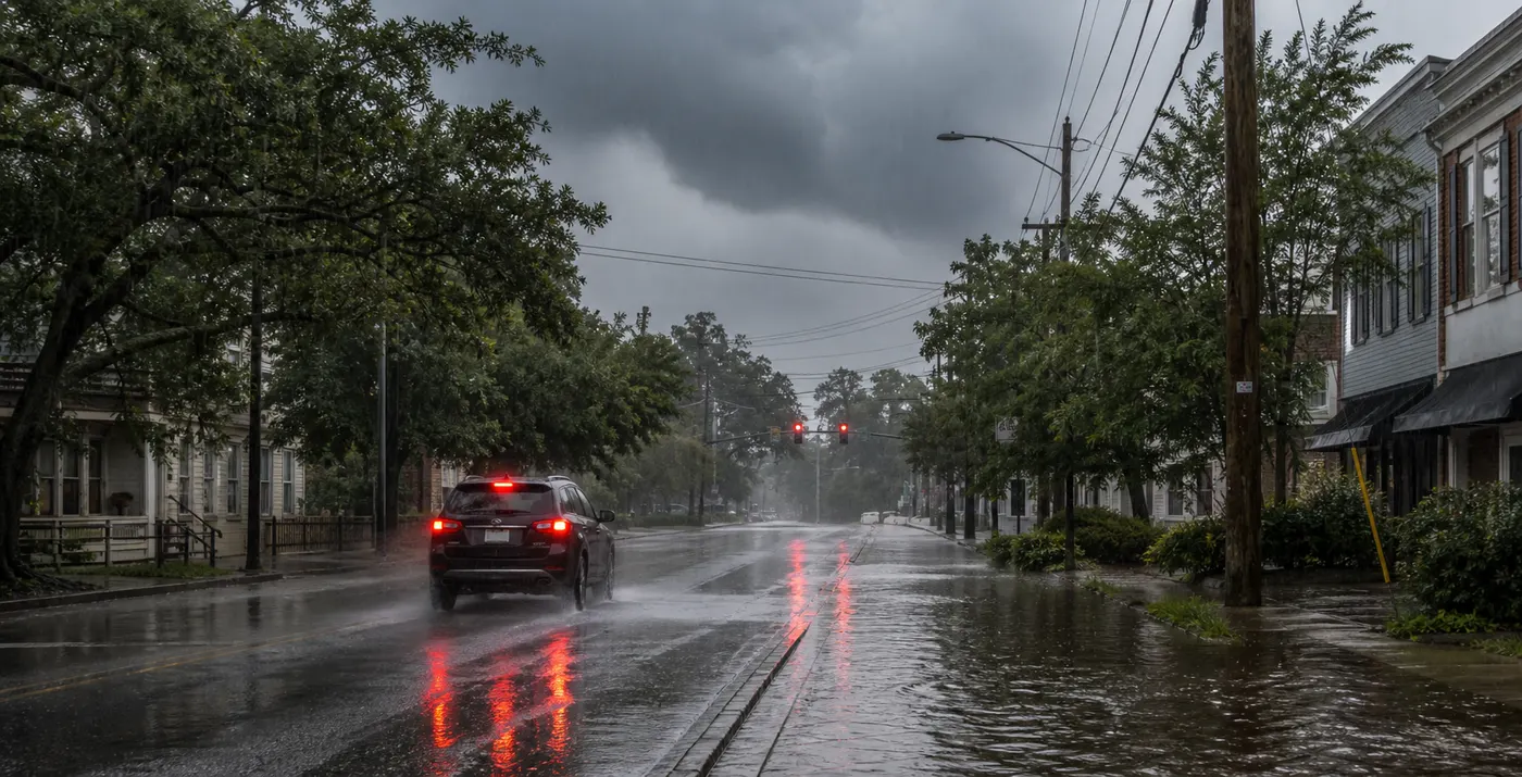
Friday's strongest weather story in the Carolinas is not about chasing a storm name or waiting for a dramatic severe-weather map. It is about what repeated heavy rain can do to roads, parking lots, drains, low spots, and a normal drive home when the ground has already taken on too much water.
The sharpest flood concern sits in eastern North Carolina and coastal South Carolina, where official forecasts already line up with same-day watches. Central North Carolina is a step below that core zone, but it still has enough rain risk tonight to make urban flooding and poor-drainage trouble worth planning around now rather than improvising later.
Why the Carolinas are the main flood story this morning
The Weather Prediction Center's Day 1 excessive-rainfall outlook, updated at 0814 UTC Friday, puts a Moderate Risk across portions of the Southeast and says the Carolinas have the greatest risk for flash flooding. Its discussion points to a stalled front, deep tropical moisture, and slower storm motions later today and tonight.
That combination matters because it raises the odds of storms dumping a lot of rain over the same area instead of moving through quickly. WPC says the 24/00Z HREF and RRFS show rainfall rates above 3 inches per hour focused first along coastal South Carolina and a small portion of adjacent North Carolina. That is enough to turn a familiar road or errand into the wrong choice fast, even if the afternoon starts quietly.
What eastern North Carolina should take seriously today
National Weather Service Newport and Morehead City says a Flood Watch remains in effect through Saturday morning for a broad eastern North Carolina zone that includes Duplin, Lenoir, Jones, Craven, Onslow, Carteret, Pamlico, Ocracoke Island, and Hatteras Island. The office's Hazardous Weather Outlook says heavy rain capable of flooding is possible today and tonight, with an elevated excessive-rainfall and flash-flood risk continuing into Saturday.
The practical takeaway is simple. If your day includes low coastal roads, repeat errands, beach traffic, causeways, or flood-prone urban spots from Jacksonville to New Bern to Morehead City, today is not the day to assume the usual route will hold up.
Why coastal South Carolina needs a noon-to-evening plan
National Weather Service Charleston has a Flood Watch from noon through this evening for Charleston and surrounding Lowcountry counties including Charleston, Dorchester, Berkeley, and Colleton. Its watch says excessive rainfall could flood low-lying, poor-drainage, and urban areas, with 3 to 5 inches possible in some locations as a slow-moving front interacts with the afternoon sea breeze.
That setup is especially good at turning a normal summer storm day into a parking and mobility problem. The useful question is not whether every neighborhood floods. It is whether your usual work, school, restaurant, or grocery route has even one recurring low spot that becomes a bad bet when two rounds of rain line up.
Central North Carolina is lower-risk, not no-risk
The flood story is not only coastal. National Weather Service Raleigh says locally heavy rain and a marginal flooding risk are possible tonight, mainly in urban and recently rain-soaked areas. ABC11's early Friday live updates also kept central North Carolina in active storm and flood tracking as showers moved through the morning.
That means Raleigh, Durham, and nearby communities should think more in terms of nuisance flooding, backed-up drains, and a slower evening commute than widespread flash-flood headlines. But nuisance flooding is still a real travel problem when you discover the bad underpass or pooled side street too late.
What to change before the heaviest rain arrives
- Check your local National Weather Service office before lunch and again before the evening drive.
- If your normal route depends on a low spot, coastal road, creek crossing, or known drainage problem, choose the alternate now.
- Move the car out of the usual ponding area before heavy rain starts instead of after the first warning.
- Charge phones, backup batteries, and any power-dependent medical gear in case flooding and thunderstorms knock power out locally.
- Decide which plans you will cancel if a Flood Warning or Flash Flood Warning is issued for your area.
The mistake people make on days like this is treating flooding like a dramatic event that only counts if the whole town is underwater. Most of the damage starts smaller than that: one flooded road, one stalled car, one parking lot that fills too quickly, one delay that turns into the wrong time to be out.
Flooded-road rules still matter more than radar confidence
Ready.gov's flood guidance says to find safe shelter right away under a flood warning and not to walk, swim, or drive through flood water. It repeats the rule that matters most because people keep breaking it: Turn Around, Don't Drown.
The same guidance says just six inches of moving water can knock a person down and one foot of moving water can sweep a vehicle away. If your route includes a road that tends to flood, you do not need perfect radar interpretation. You need a no-go rule before you leave.
If the rain turns into an outage problem
Flood days can become outage nights, especially when heavy rain overlaps with thunderstorms. Ready.gov says to keep freezers and refrigerators closed as much as possible, disconnect appliances and electronics to avoid surge damage, and use generators only outdoors and away from windows.
If you need a longer outage checklist, Tadpost's power-outage heat-wave guide and blackout kit checklist cover the next-hour basics in more detail.
What to recheck later today
- the latest local Flood Watch, Flood Warning, or Flash Flood Warning text from your National Weather Service office
- the Weather Prediction Center excessive-rainfall outlook if the heavier axis shifts
- state DOT or local road-closure pages before any long drive across eastern North Carolina or the South Carolina Lowcountry
- local utility outage maps if storms begin producing power interruptions near you
- your parking plan if your vehicle is in a low spot or on a flood-prone street
FAQ
Where is the highest Carolinas flood risk on July 24?
WPC says the Carolinas have the greatest flash-flood risk in today's Moderate Risk area, with the sharper signal focused first along coastal South Carolina and adjacent North Carolina.
Which parts of North Carolina are under a Flood Watch?
National Weather Service Newport and Morehead City says a Flood Watch remains in effect through Saturday morning for parts of eastern North Carolina including Duplin, Lenoir, Jones, Craven, Onslow, Carteret, Pamlico, Ocracoke, and Hatteras.
Is Charleston under a Flood Watch today?
Yes. National Weather Service Charleston says a Flood Watch is in effect from noon through this evening for Charleston and nearby Lowcountry counties, with 3 to 5 inches possible in some locations.
What about Raleigh and the central North Carolina commute?
National Weather Service Raleigh says locally heavy rain and a marginal flooding risk are possible tonight, mainly in urban and recently rain-soaked areas. That is more of a route and drainage problem than a broad coastal-style flood watch signal right now.
What is the most useful flood rule today?
Do not drive through water-covered roads, and do not wait until the street is already ponding to decide on a backup route.
Sources
- Weather Prediction Center Day 1 Excessive Rainfall Outlook, updated 0814 UTC July 24, 2026.
- National Weather Service Newport and Morehead City Hazardous Weather Outlook and Flood Watch text for eastern North Carolina, issued 0605 to 0609 EDT July 24, 2026.
- National Weather Service Charleston Flood Watch text, issued 0218 EDT July 24, 2026.
- National Weather Service Raleigh Hazardous Weather Outlook, issued 0647 EDT July 24, 2026.
- ABC11 Raleigh live weather updates, checked July 24, 2026.
- Ready.gov flood guidance, checked July 24, 2026.
- Ready.gov power-outage guidance, checked July 24, 2026.
The bottom line
Friday's Carolinas weather problem is repeated heavy rain over places that do not need much help to flood. Eastern North Carolina and coastal South Carolina have the sharper official watch setup, while central North Carolina still needs to respect urban flooding and a slower evening commute. The best move is not overthinking the map. It is deciding now which route, parking spot, or errand is not worth testing once the heavier rain starts.