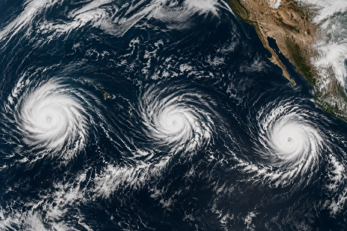
Three hurricanes are active in the Pacific on Friday, September 4, 2026, but they should not be treated as one combined threat. Karina and Marie are in the eastern Pacific, while Lowell is in the central Pacific south of Hawaii.
The National Hurricane Center’s latest homepage update, fetched at 10:50 UTC, lists active advisories for all three systems. The practical question is not simply which storm is strongest. It is which official forecast, marine statement, surf product, or local alert applies to your location or route.
What the latest advisory says
Hurricane Karina was near 20.4°N, 139.3°W and moving west-northwest at 9 mph. Maximum sustained winds were 100 mph. The NHC summary described Karina as slightly weaker but still with winds near 100 mph.
Hurricane Marie was near 19.9°N, 117.1°W and moving west-northwest at 9 mph, with maximum sustained winds of 100 mph. The latest summary said Marie could strengthen some more today.
Hurricane Lowell was near 13.4°N, 159.6°W and moving west at 9 mph, with maximum sustained winds of 125 mph. The Central Pacific summary says interests in the Hawaiian Islands should continue to monitor Lowell’s progress.
What Karina means for Hawaii and offshore interests
Karina is well east of the Hawaiian Islands in the latest summary. That location does not by itself create a Hawaiian land warning. It does matter for marine interests, long-distance voyages, and coastal plans that could be affected by changing wind, swell, or surf conditions.
Use the forecast track, wind field, wind-speed probabilities, and local marine or surf statements together. The center line is not a precise boundary for all impacts.
What Marie means for Baja California and Mexico
Marie is several hundred miles west-southwest of the southern tip of the Baja California Peninsula. Its category does not answer local questions about beaches, ports, roads, or travel. Residents and visitors should check Mexican authorities, local weather products, port notices, and surf statements for decisions on the peninsula.
A distant hurricane can still produce dangerous swell and rip currents away from its center. Follow beach closures and lifeguard instructions even when the storm is offshore.
What Lowell means for Hawaii
Lowell is several hundred miles south of Hawaii and moving west. The NHC’s current message is a reason to monitor the storm, not a substitute for a local warning or evacuation instruction. Rain, wind, surf, and rip-current impacts depend on the storm’s future track and local conditions.
If you are in Hawaii, check the Central Pacific Hurricane Center, your local National Weather Service office, county emergency management, and official alerts sent to your location before boating, swimming, hiking, or traveling between islands.
What boaters, beachgoers, and travelers should do
- Boaters: review the latest marine forecast, wind field, wave and swell information, port notices, and communications coverage along the route.
- Beachgoers: check local surf and rip-current statements. Do not enter water closed by officials or lifeguards.
- Travelers: confirm status directly with airlines, airports, cruise operators, ferries, and local transportation agencies.
- Households: keep alerts enabled, charge essential devices, secure loose outdoor items, and follow local instructions if a warning is issued.
How to read the next update
- Note the advisory time and whether the track or forward speed changed.
- Check intensity and how far hurricane-force or tropical-storm-force winds extend.
- Look for local rain, flood, high-surf, rip-current, or marine products.
- Follow watches, warnings, closures, and evacuation instructions from local officials.
The forecast cone describes uncertainty in the storm’s center. It does not show every place that can experience dangerous wind, rain, surf, or currents.
FAQ
Which hurricane is strongest?
In the latest NHC homepage snapshot, Lowell had the highest listed maximum sustained winds at 125 mph. Karina and Marie were each listed at 100 mph. Wind speed alone does not determine local danger.
Is Lowell headed for Hawaii?
Lowell was south of Hawaii and moving west in the cited update. Check the latest Central Pacific Hurricane Center forecast and local Hawaii alerts for current track and impacts.
Where should I get the latest information?
Start with NHC, the Central Pacific Hurricane Center outlook, your local National Weather Service office, and local emergency management. For travel, check the carrier or operator directly.
Bottom line
Karina, Marie, and Lowell are three separate Pacific hurricane stories. Karina is east of Hawaii, Marie is west-southwest of Baja California, and Lowell is south of Hawaii. Follow the official forecast and local hazard products for your location instead of treating the three names as one uniform threat.
Sources
- National Hurricane Center homepage, active-system summary and advisory links, refreshed September 4, 2026.
- NHC and Central Pacific Hurricane Center Tropical Weather Outlook, refreshed September 4, 2026.
- National Weather Service hurricane safety resources.
- NOAA/NHC Saffir-Simpson Hurricane Wind Scale.